ATLANTA — UPDATE: Model trends and new data have increased expected totals. CLICK HERE for our latest updated story.
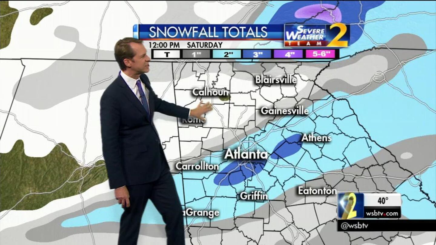
A Winter Storm Watch will go into effect Friday night when 2-4 inches of snow is forecast to fall in parts of north Georgia and metro Atlanta.
Severe Weather Team 2 is tracking the system as it moves closer to Georgia.
A cold front has already started moving in from the northwest, bringing in much colder air to most of the state.
Watch Channel 2 Action News throughout the day for the latest forecast models showing when and where the winter weather will be.
Winter Storm Watch N GA. Potential 1-2" snow in metro isolated 3" amounts. Expect changes in coverage & amounts. pic.twitter.com/ob9zyO0SOF
— Karen Minton (@KarenMintonWSB) January 5, 2017
[DOWNLOAD: Severe Weather Team 2 Weather App]
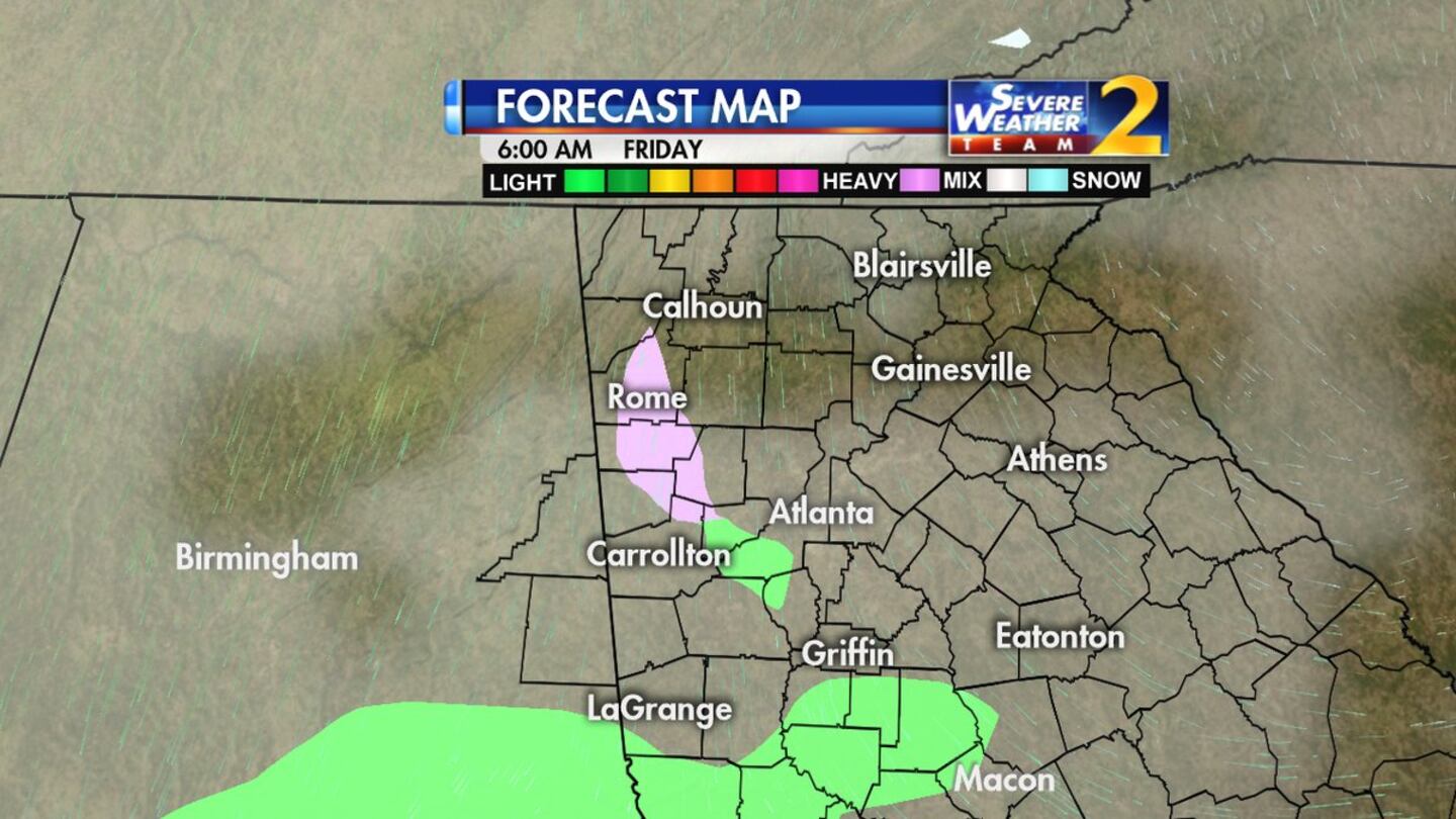
The focus will be later in the day Friday, with snow building in the north Georgia mountains as early as mid to late afternoon.
“As we head into the evening hours, the snow chances will be increasing,” said Severe Weather Team 2 Meteorologist Karen Minton.
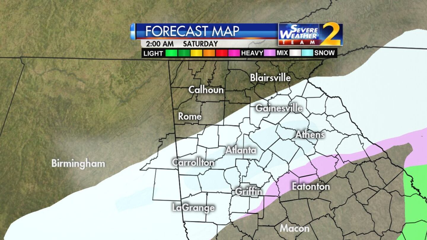
Around 9 p.m. Friday, snow in the northeast Georgia mountains builds down to the south and west and may start as a mix of freezing rain and sleet south of Interstate 20.
“From the I-20 corridor northward, it’s going to be primarily if not completely snow,” Minton said.
Through the early hours of Saturday, more widespread snow will develop and start to accumulate. Temperatures will fall into and through the 20s from Friday night into Saturday.
Snow will continue to fall through 8 a.m. and by midday on Saturday, the snow is expected to come to an end.
"In the metro area, one to two inches of snow, with some isolated pockets of three inches, maybe up to four inches in some mountain areas," Minton said.
On Thursday, Georgia Department of Transportation crews began prepping roads for the winter weather.
"The amount of snow will be varied, and it's still not exact in our forecast, we're waiting for additional data later today so we'll be fine-tuning this," Minton said.
After the winter weather moves out, we’ll see the return of sunshine heading into Sunday.
Channel 2's Tom Regan has learned that the Georgia Department of Transportation is readying brine trucks Wednesday.
Developing: Brine trucks loading as GDOT preps for winter weather event in the next two days. What they expect on the roads/ch2@5pm. pic.twitter.com/YItb5z0ufv
— Tom Regan (@tomreganWSB) January 4, 2017
Behind this system, it will turn bitterly cold Saturday afternoon and through early next week with temperatures in the lows teens/low 20s and highs only in the 30s.
Stay with WSBTV.com and Channel 2 Action News as our team of five meteorologists tracks the latest forecast models to keep you one step ahead of the winter weather headed our way.
You can also follow our meteorologists on Twitter throughout the next few days for the latest on the winter forecast: @GlennBurnsWSB, @KarenMintonWSB, @BradNitzWSB, @BMonahanWSB and @KatieWallsWSB.
Cox Media Group


