
ATLANTA — Despite a decent, warm Wednesday, north Georgia needs to prepare for more storms.
A cold front is expected to move in overnight and ahead of it will be strong to severe storms.
Gordon County and Calhoun City Schools are opening on a two-hour delay Thursday over the threat of flooding.
[Download FREE Severe Weather Team 2 app for latest watches and warnings]
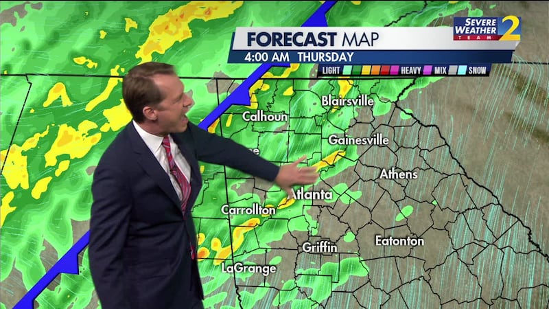
The northwestern part of the state is under a Level 2 threat for storms that could produce heavy rain, strong winds and the possibility of an isolated tornado.
Much of the western part of the Atlanta metro will be under a Level 1 threat for storms.
Severe Weather Team 2 is tracking the rain that could impact your morning commute, on Channel 2 Action News This Morning, starting at 4 a.m.
Here’s what you need to know:
- Storms will move into the northwestern corner of the state around 1 a.m.
- The system will move southeast toward the metro, weakening as it moves through
- Temperatures will drop significantly behind the cold front
A Flash Flood Watch has been issued for parts of the north Georgia mountains that have already seen large amounts of rain over the last couple of weeks.
FLASH FLOOD WATCH has been issued again for more heavy rain coming in Thursday morning. Rivers, streams, and creeks are already high and flooding remains a threat. pic.twitter.com/vQAYIP4o70
— Brad Nitz (@BradNitzWSB) February 12, 2020
© 2020 Cox Media Group


