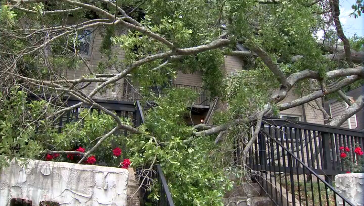
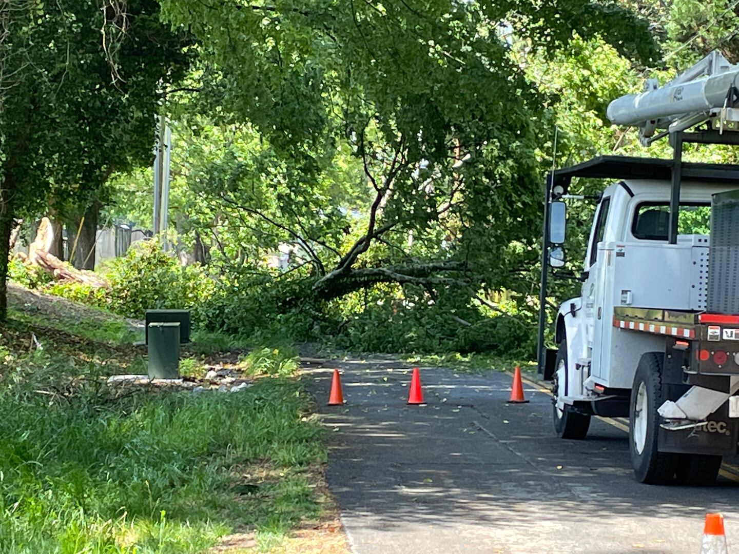
ATLANTA — A line of strong storms moved through parts of Georgia Friday, and gusty winds downed trees and power lines across metro Atlanta.
One tree fell on a man in downtown Atlanta. His condition and identity have not been released.
[DOWNLOAD: Free Severe Weather Team 2 App for alerts wherever you go]
The majority of north Georgia was initially on a level 3 risk for severe storms and potential tornadoes, but drier air that moved in was able to break the system apart.
Parts of the far northeast corner of Georgia are still under a tornado watch until 8 p.m.
LIVE UPDATES:
4:35 p.m.
A tree fell on a man in downtown Atlanta, injuring him.
4:29 p.m.
The tornado watch has been canceled for several northeast Georgia counties as storms quickly move east.
Tornado watch has been canceled for several counties in north Georgia as the threat is moving quickly northeast. The watch remains in effect for NE Georgia for now. pic.twitter.com/JxFaHeeelL
— Brad Nitz (@BradNitzWSB) May 6, 2022
4:27 p.m.
Around 14,000 people are currently without power across the state.
3:39 p.m.
Upson County has been dropped from the tornado watch area.
3:34 p.m.
Georgia Power is reporting nearly 2,000 people without power in the Hickory Flat area.
Large power outage reported in Hickory Flat to Freehome area. Several traffic lights are out. Expect major delays around Hickory Flat Hwy. and East Cherokee Dr. Avoid the area if possible. Use caution driving in the area.
— Cherokee Sheriff’s Office (@CherokeeSO) May 6, 2022
3:18 p.m.
GreyStone Power is reporting more than 2,500 power outages in metro Atlanta, mostly in Fulton County.
2:48 p.m.
Severe Weather Team 2′s Brad Nitz says a wind advisory has been issued for most of North Georgia:
2:24 p.m.
A severe thunderstorm warning has been issued for Lumpkin, Union, White and Towns counties until 2:45 p.m.
Severe thunderstorm warning for parts of Lumpkin, White, and Union counties until 2:45 pm. 60 mph gusts and 1" hail is possible. These storms are moving NE at 40 mph. pic.twitter.com/z8ZBYSoGsB
— Brad Nitz (@BradNitzWSB) May 6, 2022
2:14 p.m.
Strong winds have toppled a tree onto an apartment complex on Dalvigney Ave.
1:41 p.m.
A second tornado watch has been issued for parts of northeast Georgia including Banks, Dawson, Fannin, Gilmer, Habersham, Hall, Lumpkin, Pickens, Rabun, Towns and Union counties until 8 p.m.
A tornado watch has been issued for far north and northeast Georgia until 8 pm. A second tornado watch to the south includes Upson county in the Channel 2 viewing area.
— Brad Nitz (@BradNitzWSB) May 6, 2022
The threat is lower in metro Atlanta. pic.twitter.com/CnQZmVsG5D
1:28 p.m.
Heads Up Brookhaven! Traffic Lights are Out on Peachtree Rd. at N. Druid Hills Rd. Police are directing traffic. Delays. #ATLtraffic pic.twitter.com/frLqnqrWAi
— Triple Team Traffic (@WSBTraffic) May 6, 2022
12:57 p.m.
A tornado watch has been issued for parts of the Channel 2 Action News viewing area including Upson, Houston and Monroe counties until 7 p.m.
Tornado watch until 7 pm EDT includes Upson County in the Channel 2 viewing area, and much of middle and south Georgia.
— Brad Nitz (@BradNitzWSB) May 6, 2022
A separate watch may be issued for north Georgia this afternoon. pic.twitter.com/DjmWRrelaU
12:45 p.m.
Storms earlier Friday downed multiple trees in East Lake.
12:42 p.m.
The level 3 risk for severe storms has shifted slightly this afternoon but the threat remains the same for most of metro Atlanta.
The updated severe weather outlook trims parts of west Georgia out of level 3 risk and drops to level 2. Otherwise, there are no changes and we still expect scattered strong to severe storms into the afternoon hours. @wsbtv pic.twitter.com/Wx5sNALrfg
— Brian Monahan, WSB (@BMonahanWSB) May 6, 2022
11:30 a.m.
Scattered showers are forming in west Georgia ahead of storms starting around noon.
Watching this area over west Georgia for storms to develop -- scattered showers now. Sun is coming back out which will help destabilize the atmosphere. @wsbtv pic.twitter.com/zqDfhtU5bH
— Brian Monahan, WSB (@BMonahanWSB) May 6, 2022
[INTERACTIVE: StormTracker 2HD Radar]
Late Friday afternoon and into the evening, dry air and sunshine should return.
[UPLOAD PHOTOS: Share your weather photos with us here]
Here’s what you need to know for Friday:
- Line of storms to move in around midday
- Moderate risk for tornadoes, but not zero
- Possible damaging wind and hail
- Drier, stable air to move in behind storms
©2022 Cox Media Group


